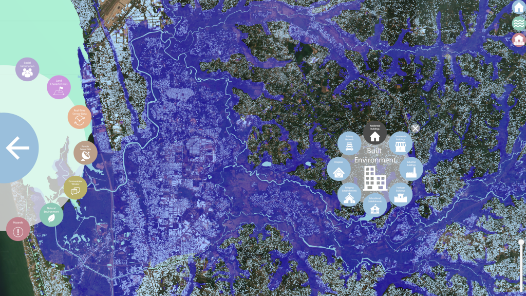
The University of Salford’s THINKlab is working in the Kalutara District of Sri Lanka to pilot the MOBILISE digital platform and help to build climate resilience and community-based early warnings systems. The project will help local agencies and communities to work together to build their local resilience against climate-induced disasters such as landslides and floods.
The grant is part of the Program for Asia Resilience to Climate Change, run by the World Bank, funded by the UK’s Foreign, Commonwealth & Development Office, and administered by the Asian Disaster Preparedness Centre. The innovation project is one of 16 winning projects, selected from 236 competitive proposals submitted to the climate change innovation challenge led by the Asian Disaster Preparedness Centre.
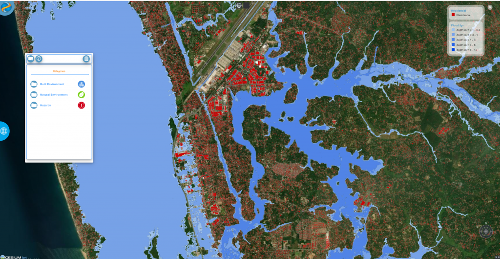
The project will trial a range of digital solutions developed by THINKlab and Tecxal Systems Ltd in Sri Lanka to overcome limitations in current approaches in preparing for climate-induced disasters. One of the key challenges faced by many countries, such as Sri Lanka, is the lack of an intelligence-driven approach for addressing local disaster risk reduction activities. At present, important climate and disaster risk data are scattered across many government agencies. As a result, it is difficult for government agencies, both at the national and local level to compile relevant intelligence, necessary for building community resilience against climate change and issuing effective early warnings.
This digital innovation project aims to establish a shared risk information environment and a data-driven decision support system for the local agencies in Kalutara to implement a participatory approach for identifying local risks and agreeing on adaptation and risk mitigation actions. Furthermore, the digital solutions developed as part of the project will trial a community-based early warning system where communities themselves can offer important intelligence to relevant officials through crowdsourcing techniques and receive timely alerts and warnings in advance of possible disaster risks, hence saving lives. The project will also explore smart city solutions for sending early warning messages to communities that are out of mobile signal coverage.
In Sri Lanka, the inter-monsoons arrive in April and at the end of May begins the Southwest Monsoons, which are associated with landslides, posing a real danger to the communities living beneath mountains with the potential to harm lives and properties. Historical data shows that between 2000-2020, landslide incidents in Sri Lanka have affected more than 152,000 people, and caused 557 deaths with another 236 missings. Landslides stand are the fifth fatal disaster in the country, below the COVID-19 pandemic, animal attacks, floods, and the 2004 tsunami.
The most effective landslide risk reduction strategy is the removal of people living on landslide-prone slopes. However, due to high cost, complex administrative procedures, long implementation period, and other social and economic reasons, relocating vulnerable communities is unlikely or a long-term option. For those who are living in landslide-prone areas, receiving alternative safe land is a rare option, so they would have to learn to live with risks. Generally, vulnerable landslide-prone areas are occupied by people who are compelled to live in those areas. As small-scale tea growers or workers in the tea or rubber industries, many communities work and live in the same locality. Therefore, hundreds of vulnerable communities living on mountain slopes need innovative solutions for their survival against possible landslides.
In this context, the landslide early warnings are currently being practised as the best lifesaving alternative. This approach involves continuous monitoring of the rainfall level in landslide high-risk areas by National Building Research Organisation and issuing warnings of a possible landslide threat. These warnings are then disseminated by the Disaster Management Center through public media and intra-government networks so that vulnerable communities can be vigilant about possible landslides. However, landslides are solitary and isolated events that mainly depend on unique local factors such as the exposure of the mountain slope to monsoonal rains, the angle of slope, the vegetation of the slope, soil type, etc. Therefore, early warning systems that are well informed about local situations, and can predict landslide risk for specific areas will be the best option for many communities living with landslide risk in the country. Furthermore, when citizens at the receiving end can participate in the early warning process, early warning becomes more effective and sustainable. The digital solutions that will be piloted in Kalutara aim to organise local communities to observe early landslide signs in their surroundings and to report landslide warnings using a mobile app. The project will use these digital solutions for sending early warnings to digitally excluded rural communities using low power communication networks such as LoRaWAN and solar-powered alarm systems installed at homes.
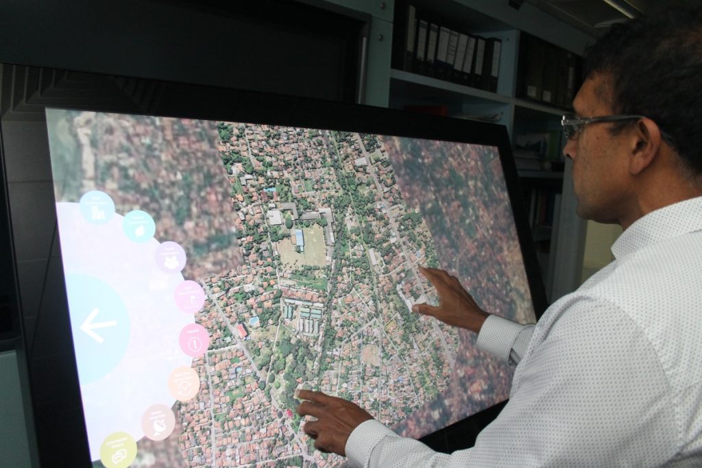
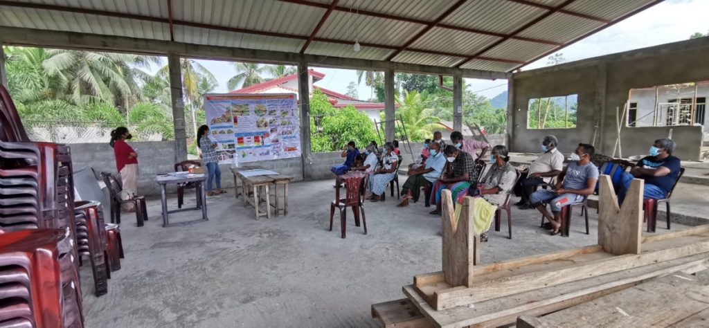
Another challenge that exists in creating safer communities is the existence of discrepancy between the risks identified by the geotechnical teams and the risk perception of the local community. As a result, some community members may completely ignore early warnings, consequently making them vulnerable to landslides. Therefore the project aims to trial the use of interactive visual maps as a way of discussing local risks with the communities with the view to establishing a more accurate perception of risks, during community engagement meetings run by the National Building Research Organisation.
It is possible that climate change will lead to heavy rains in the future, hence triggering frequent landslides. It is therefore important that local agencies establish a clear understanding of the current and future local risks due to climate change in developing their local land use plans and economic development activities. The project aims to trial the MOBILISE digital platform developed by the University of Salford in the UK to establish a local risk information space and decision-making space for reducing risks through better planning. The MOBILISE platform will allow the local stakeholders to explore and establish a common understanding of the local risks in their area. Further, a ‘Scenario Generator” of the MOBILISE platform will allow government agencies to consider possible future hazards due to climate change, and gain an in-depth understanding of the magnitude of the potentially affected population, impacted roads, and critical infrastructure, and damage and losses within different administrative boundaries.
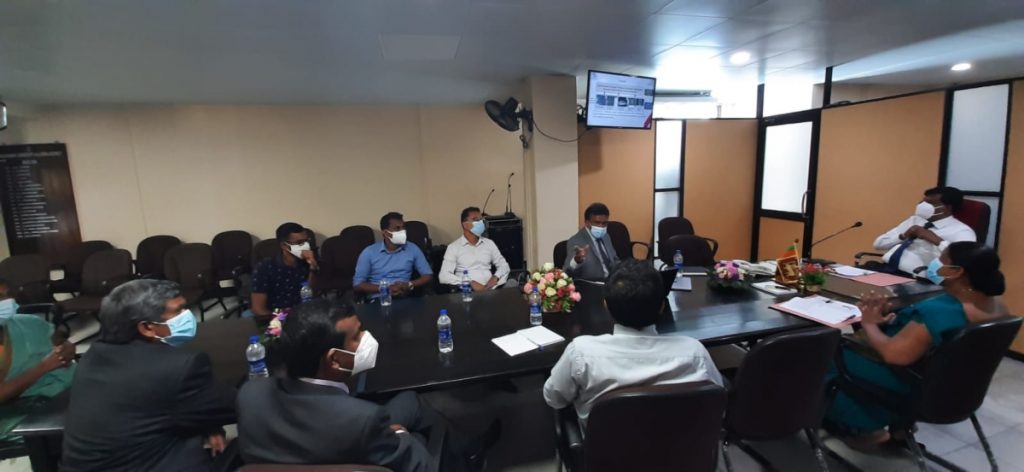
The project was launched on the 24th January 2022 by the Kalutara District Secretary and now the project team is preparing the technology to be piloted in a few areas in Kalutara in April 2002. The project will be guided by a steering committee comprised of the divisional secretary, divisional secretaries in Kalutara, and the community representatives.
For more information:
Visit the MOBILISE website for further details and to see the full services and tools available.
Read about how the MOBILISE project is using Smart City Technology for Disaster Resilience.
Understand how heterogenous sensor networks can be integrated to monitor rising rivers and rainfall.
See how the digital drone visualisation platform is helping stakeholders to interpret data more quickly and strengthen their decision-making when responding to disaster situations.
